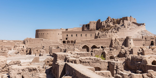
Bam is situated in a desert environment on the southern edge of the Iranian high plateau. The origins of Bam can be traced back to the Achaemenid period (6th to 4th centuries BC). Its heyday was from the 7th to 11th centuries, being at the crossroads of important trade routes and known for the production of silk and cotton garments. The existence of life in the oasis was based on the underground irrigation canals, the qanāts, of which Bam has preserved some of the earliest evidence in Iran. Arg-e Bam is the most representative example of a fortified medieval town built in vernacular technique using mud layers (Chineh).
The property of Bam and its Cultural Landscape is located on the southern edge of the Iranian high plateau, in Kerman Province, in south-eastern Iran, close to the Pakistan border. Bam lies 1,060 metres above sea level in the centre of the valley. This valley forms the wider cultural landscape of the Bam County. Beyond the mountains lies the vast Lut Desert of Central Iran. Water from the Jebal-e Barez Mountains supplies the seasonal Posht-e Rud River that skirts Bam City between Arg-e Bam and Qal’eh Doktar. The Chelekhoneh River and its tributaries gather water from the central parts of the Jebal-e Barez Mountain range. It now runs northeast, although it formerly flowed through the Bam City until it was diverted by a dam into a new course that met with the Posht-e Rud northwest of Bam City. Water from the Kafut Mountains also supplies the catchment area.
Arg-e Bam
December 20, 2021
0 comment

Comment (0)